Roswell inks deal to create 50-acre city park from family estate Josh Green Thu, 06/26/2025 - 11:01
For the second time this year, Roswell has allocated significant resources toward beefing up the city’s roster of greenspaces.
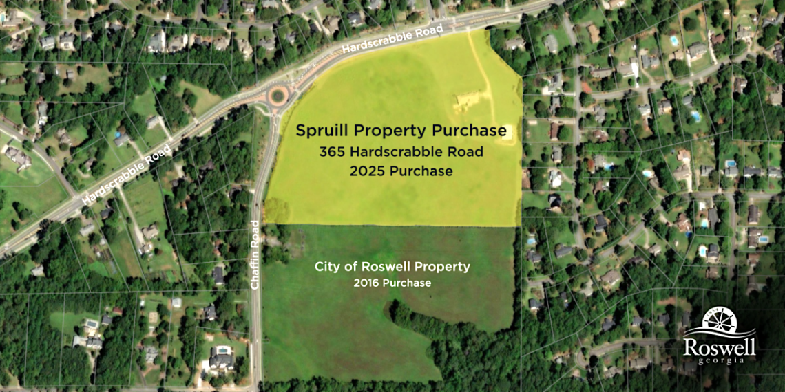
City officials this week entered a purchasing agreement with private landowners to buy 24 acres at 365 Hardscrabble Road, a family estate property near Roswell High School.
Plans call for combining the acreage, formerly owned by the Estate of Edwin Spruill, with an adjacent 25 acres the city already owns to create a roughly 50-acre public park space.
The greenspace, envisioned as a “new cornerstone of recreation and community engagement,” will be called “Edwin and Nelda Spruill Park” to honor the longtime owners’ commitment to the city and legacy, according to Roswell officials.
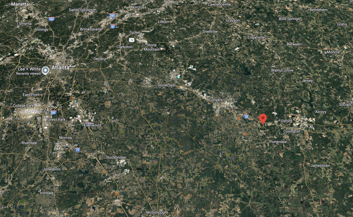
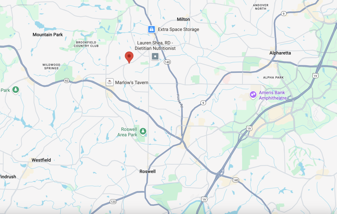
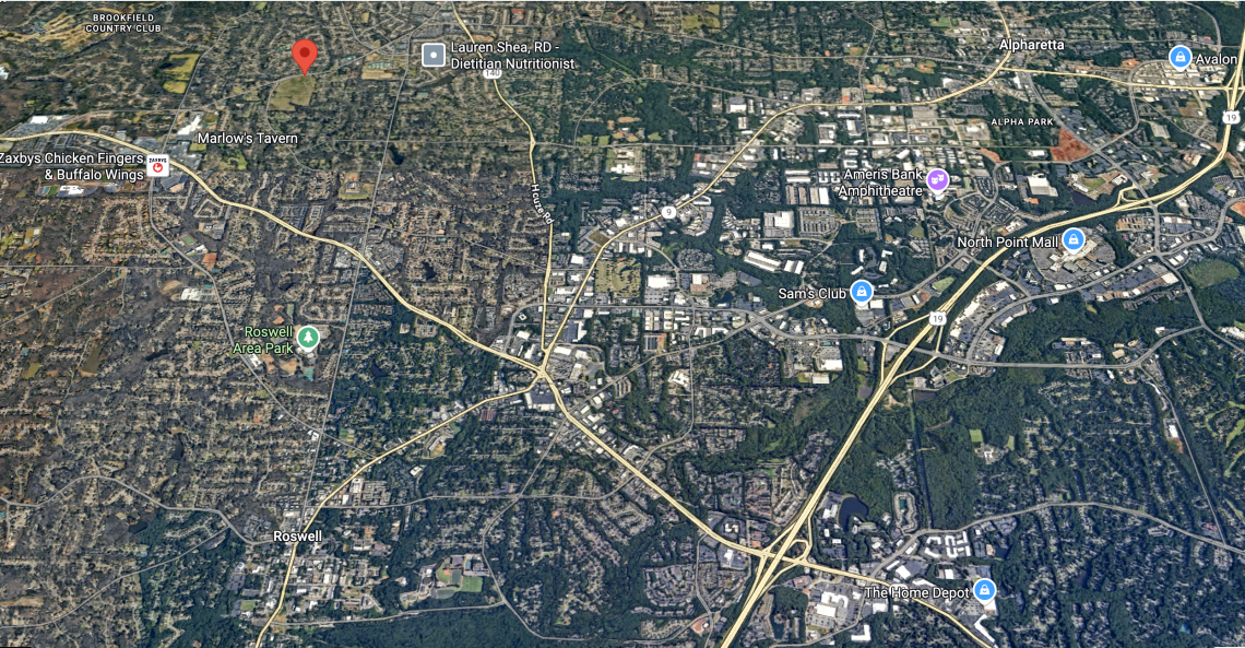 The Edwin and Nelda Spruill Park site (top left) in relation to Roswell and Alpharetta downtowns. Google Maps
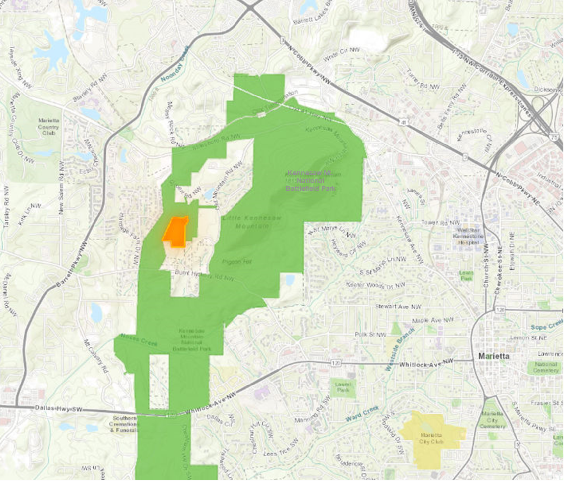
 Full scope of the future park property in question, at left, as seen in July. Google Maps
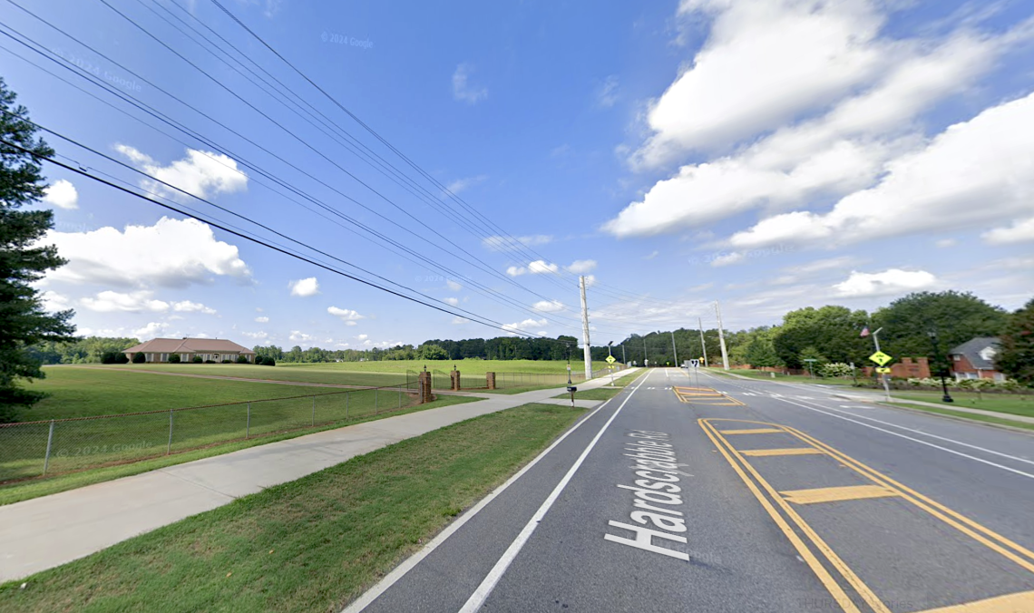
The future park site—drastically wide-open by Georgia’s thickly wooded standards—is located about four miles north of Roswell's historic downtown. Alpharetta City Center is roughly five miles to the east.
The city has agreed to purchase the 24 acres for $7.5 million and expects to close on the deal within about three months of the Roswell City Council’s approval.
 Courtesy of City of Roswell
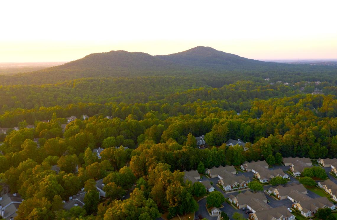
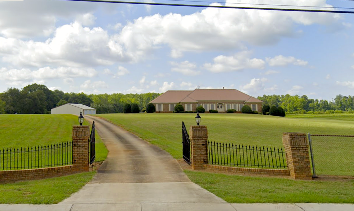 Entry to the Spruill estate today. An overview of a large open property north of Atlanta near many houses where a 50-acre new park is planned soon.
Next steps call for long-term planning efforts that will determine the park’s layout and amenities.
City officials describe the deal as a major land acquisition that will significantly expand Roswell’s park offerings, preserve open space, and boost the North Fulton County city’s quality of life.
In February, Roswell city officials broke ground on a $4.8-million upgrade at popular East Roswell Park that will produce better trail connectivity and ADA access, a bigger dog park, a new playground, stormwater management, and other improvements, per city officials.
 Where the 50-acre greenspace will take shape north of Roswell's historic district. Google Maps
...
Follow us on social media:
Twitter / Facebook/and now: Instagram
• Roswell news, discussion (Urbanize Atlanta)
Tags
Hardscrabble Road at Chaffin Road Edwin Spruill Mayor Kurt Wilson City of Roswell Roswell Georgia OTP Atlanta Suburbs Atlanta Parks Parks and Rec Edwin and Nelda Spruill Park Roswell News Roswell Parks Roswell High School
Images
The Edwin and Nelda Spruill Park site (top left) in relation to Roswell and Alpharetta downtowns. Google Maps
Courtesy of City of Roswell
Full scope of the future park property in question, at left, as seen in July. Google Maps
Entry to the Spruill estate today. An overview of a large open property north of Atlanta near many houses where a 50-acre new park is planned soon.
Where the 50-acre greenspace will take shape north of Roswell's historic district. Google Maps
Subtitle Fulton County city envisions site as future “cornerstone of recreation and community engagement”
Neighborhood Roswell
Background Image
Image

Before/After Images
Sponsored Post Off