this post was submitted on 25 Mar 2024
417 points (98.8% liked)
Damn, that's interesting!
4677 readers
2 users here now
- No clickbait
- No Racism and Hate speech
- No Imgur Gallery Links
- No Infographics
- Moderator Discretion
- Repost Guidelines
- No videos over 15 minutes long
- No "Photoshopped" posts
- Image w/ text posts must be sourced in comments
founded 4 years ago
MODERATORS
you are viewing a single comment's thread
view the rest of the comments
view the rest of the comments
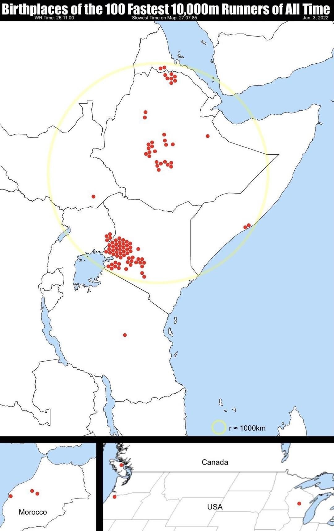
The topography explains it all. https://geology.com/articles/east-africa-rift.shtml
tl;dr The people of that area in East Africa naturally live close to sea level, however there are easily accessible elevations changes that distance runners have trained on for probably centuries. It turns out that training at high altitudes and recovering at low altitudes provides a tangible and demonstrable advantage compared to just single elevation training.
That’s good. I thought the map was being racist
Maps aren't racist. Map owners are racist. Map creators are just filling demand.
(replace "maps" with "dogs" and "racist" with "at fault for dog eugenics")