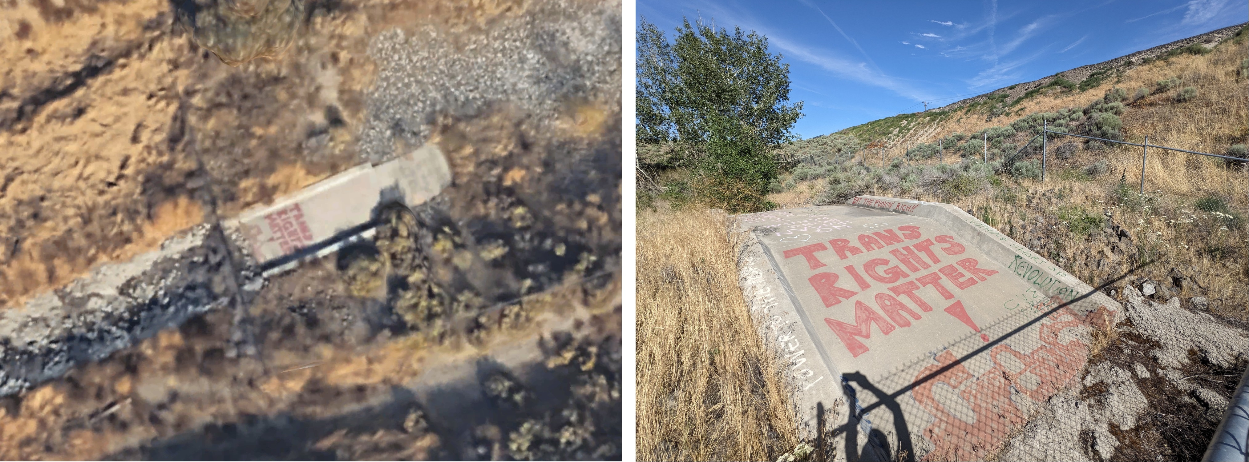
"Trans Rights Matter!" spotted on Google Earth.
Also painted on there:
Eat the fuckin' rich!!
No human being is illegal
Nothing short of revolution will save us
Behavior rules:
Posting rules:
NSFW: NSFW content is permitted but it must be tagged and have content warnings. Anything that doesn't adhere to this will be removed. Content warnings should be added like: [penis], [explicit description of sex]. Non-sexualized breasts of any gender are not considered inappropriate and therefore do not need to be blurred/tagged.
If you have any questions, feel free to contact us on our matrix channel or email.
Other 196's:
"Trans Rights Matter!" spotted on Google Earth.
Also painted on there:
Eat the fuckin' rich!!
No human being is illegal
Nothing short of revolution will save us
Damn, those letters are like, 50cm? Impressive Google Earth can resolve that
To be fair most of the map imagery we use from google/apple/etc is from planes and not satellites
Ahhh ok yeah I was wondering the same thing. Still impressive.
I'm pretty sure spy satellites do have even greater resolution, only thing is that you're not gonna use something like that for a map view and it would be very inefficient, since those satellites certainly don't have the same field of view and would take a lot longer to scan the appropriate area, and are limited in number.
Google earth is scary high detail in some places. Near my hometown there are fully rendered cranes where you can see the individual metal beams that make them up in 3D.